A North Yorkshire
Village
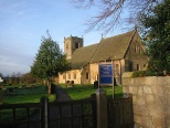
St Oswald’s Farnham
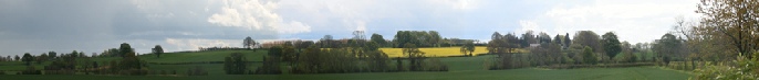
The Road to Walkingham Hall
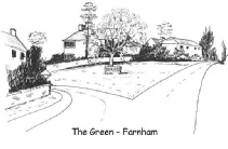
At the centre of Farnham is a small village green, where the road from Knaresborough
meets the road to the village of Scotton and onwards to the City of Ripon. But North
from the green is another road, which shortly becomes a track, and which leads to
the village of Burton Leonard. It is clear that this ancient trackway was once the
direct route between Knaresborough and Ripon. On earlier maps it is termed a bridleway
and there is evidence that it was used. as a drove road to move cattle between towns.
From the green the road climbs for a short distance to the crest of the ridge where a track forks to the right to a clump of trees which is named Folly Hill. The historian Hargrove wrote, in 1809, that in 1757 a copper mine was opened on this site 'which failed for want of proper management'. Whether the fault was management or shortage of copper will remain a mystery.
The main track then descends to a small bridge over a stream known as Shaw Beck -
Hargrove wrote that the approach
to the Hall was through an avenue of 'two rows of aged oaks.......still discernible'
and also 'remains of stables and offices with the gardens and fishponds, are very
evident'. It must have been a splendid affair. Sadly, all these signs have now disappeared
-
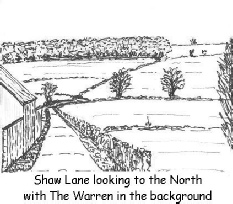
To the left of the lane and covering the hillside is Warren Covert -
There was a village
of Walkingham -